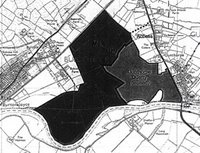
In December 2005, Nottinghamshire County Council adopted the Replacement Nottinghamshire Minerals Local Plan. This Plan sets out the county's policy on extracting minerals to meet national and regional targets. It also identifies areas where different kinds of extraction will take place.
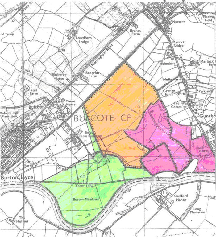
The "Gunthorpe" allocation shown on the map is mainly in Burton Joyce and Bulcote. This area has been allocated for the extraction of sand and gravel. The landowner - Severn Trent Water - proposed this site, which was supported and promoted throughout the Plan processes by Tarmac and Nottinghamshire County Council.
From July 2002 and December 2005, Burton Joyce Residents' Association fought a long, hard battle in co-operation with Bulcote Residents' Action Group (now Bulcote Conservation Trust) and Gunthorpe Environmental and Flood Alleviation Group to prevent this allocation being made. Our opposition was shared by more than eight hundred other objectors including:
- Our local MPs Vernon Coaker and Paddy Tipping
- Gedling Borough Council,
- Gunthorpe, Lowdham, Bulcote and Burton Joyce Parish Councils
- Burton Joyce Preservation Society
- Burton Joyce Local History Society
- Campaign to Protect Rural England
- Ramblers Association
- Nottinghamshire Wildlife Trust
Plus over 800 individuals local residents who will be directly affected on a day-to-day basis and concerned visitors from other parts of the county or further afield.
We put forward our view that this site is not suitable for sand and gravel extraction because:
Risk of subsidence and ground slip as a result of extraction dewatering
There is already a history of subsidence and ground slip in the area which can only be made worse by open-cast mining if millions of gallons of water are drawn down from the adjacent steep banks and the surrounding area to the quarry to enable dry extraction of sand and gravel. This is likely to affect homes on the flood plain and on the adjoining clay bank in Bulcote, Burton Joyce and part of Lowdham.Dewatering is particularly likely to affect the Bulcote Conservation Area, where there are 27 listed buildings. The whole setting of the Conservation Area will be also harmed by an open-cast mine on two sides of the Area.
Flooding
There is a history of flooding in the area, most recently in 2000, which will be made worse. This primarily concerns Gunthorpe at present but could extend to Bulcote and Burton Joyce if Burton Meadows, near the river and in the active floodplain, is mined.
Water pollution
A major water pumping station, situated between Burton Joyce and Bulcote, serves the water needs of a large part of Nottinghamshire. There is a potential risk to these water supplies in view of the history of the site for sewage disposal for over a hundred years.
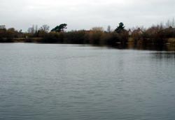
Loss of an extensively used leisure amenity area
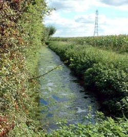
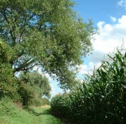
An estimated 50,000 visitors a year come to walk, ride, fish, cycle, bird-watch and enjoy the tranquillity of the area. This amenity will be destroyed.
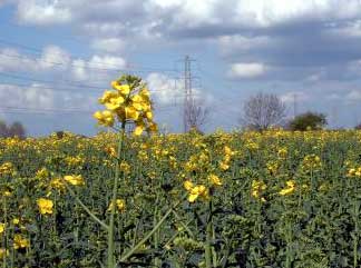
The proposed site is also in the Green Belt and part of the Greenwood
Community Forest, and as such should be protected from destruction.
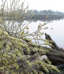
Change in landscape
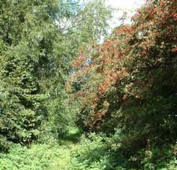
The current attractive and diverse landscape with its dykes, ponds, tree-lined lanes, and agricultural fields with wild-life encouraging edges would be destroyed and replaced by a flat landscape consisting of large masses of water.
Loss of wildlife
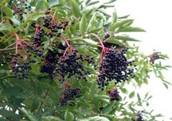
The wonderful variety of wildlife on the site would be obliterated. In particular, there is a thriving water vole population, described by a local water vole observer, as the best in the Trent Valley. Their habitat, which is protected by law, would be destroyed. In exchange, we would get an enormous increase in the numbers of Canada geese attracted by large new water masses, which will cause nuisance to nearby farmers.
Other matters that concern us are:
There are many alternative sites
Many other sites were considered by Nottinghamshire County Council in preparing this Plan. None of the others has the potential to impact adversely on such a large population, their homes and their daily lives. There was, therefore, no need to allocate this particular site as plenty of alternatives were available.
Government planning policy guidances were ignored
The government issues a wide range of planning policy guidances which local authorities must follow but Nottinghamshire County Council chose to ignore many of these requirements including the need to explore fundamental issues such as ground stability, water pollution, flooding and impact on conservation areas before allocating a specific site in the Plan.
Misleading reports were made to Councillors
Reports prepared by the Environment Department to inform County Councillors at various times when they had to vote on the Plan were inaccurate and misleading. None of the reports advised the Councillors of the complexity of the issues relating to the site and the particular dangers posed to local residents and their homes.
Our County Councillors were banned from voting in crucial votes
The Council's Monitoring Officer advised Burton Joyce's two County Councillors that they should not be present at Council Meetings, take any part in discussions or vote on Minerals Plan issues because she judged them to have personal and prejudicial interests. Legal advisers we have consulted say that this advice was wrong. As a consequence of acting on the Monitoring Officer's advice, our two Councillors have not been able to participate in important Council meetings when the Minerals Plan was on the Agenda. Particular concern focused on the Council Meeting in June 2005 when a proposal to delete the Gunthorpe allocation from the Plan was lost by 2 votes.
Future action:
The Replacement Nottinghamshire Minerals Local Plan was adopted by Nottinghamshire County Council in December 2005 but this is not the end of the matter. We believe that Nottinghamshire County Council was wrong to include the Gunthorpe allocation in the Minerals Plan without adhering to proper procedures and government guidelines. In October 2006 we made a complaint about Nottinghamshire County Council's maladministration to the Local Government Ombudsman.


 Open vistas round the
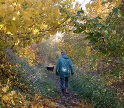
 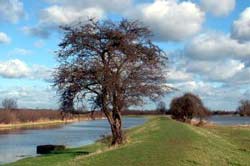 One of the many permissive paths.
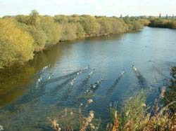
 The full monty - the big hike from Stoke Bardolph Lock along the river
edge all the way to Gunthorpe Lock, and beyond, if you want to go further.
Others may describe this walk as from the Ferry Boat Inn (Stoke Bardolph)
via the Lord Nelson (Burton Joyce) to the
The full monty - the big hike from Stoke Bardolph Lock along the river
edge all the way to Gunthorpe Lock, and beyond, if you want to go further.
Others may describe this walk as from the Ferry Boat Inn (Stoke Bardolph)
via the Lord Nelson (Burton Joyce) to the

